


| HEADLINE |

|
Sanjeev Chopra
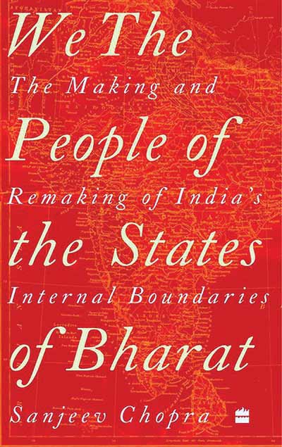
We the People of the States of Bharat
In a diverse country like India, reorganisation of State boundaries wasn\'t an easy task as Sanjeev Chopra\'s book outlines…


In a diverse country like India, reorganisation of State boundaries wasn't an easy task as Sanjeev Chopra's book outlinesďż˝
 We all know how the British divided India to carve out Pakistan, and in the process millions were uprooted, lakhs were massacred, a large number of women suffered unimaginable atrocities, and the psyche of the people on both sides was bruised forever.
Among various tasks the Indian leadership had after Independence, the most important and immediate was to secure the country's borders and reorganise boundaries of Indian provinces (as states were called under British India). The reason for this was that there were nine provinces and 562 small and large princely states at the time of Partition. These had to be integrated into the Union of India immediately otherwise, as per Mountbatten's Plan Balkan, the power would be transferred directly to rulers of princely states, and India would have been broken into several independent countries.
In his book, We the People of the States of Bharat - The Making and Remaking of India's Internal Boundaries, Sanjeev Chopra tells the story of how national borders were determined and princely states integrated into the Indian dominion. He has covered the reorganisation of States till recent times when Telangana was carved out of Andhra Pradesh, and Ladakh and Jammu and Kashmir were made Union territories.
Language diversity
India is a diverse country where different religious communities, ethnic and cultural groups reside, and several languages are spoken. The book contains several interesting episodes relating to reorganisation of the States. For instance, the Roy-Sinha proposal was that West Bengal and Bihar should be merged to create a large State. It had the support of the Chief Ministers of Bengal and Bihar, Dr. B.C. Roy and Srikishna Sinha, respectively, the Union Cabinet, and the Bihar and Bengal Assemblies. The proposal did not succeed, though creation of a bilingual State may have had the potential of setting at rest the process of insistence on a unilingual state of Maharashtra, Gujarat and later Punjab.
As a journalist I have travelled to various parts of India, specially border areas, and have often wondered how the national borders that we have today came into being.
For instance, on the bank of river Krishanganga/ Neelam, there is a village called Keran in Kupwara district of Kashmir. It forms the Line of Control in the area. Across the river is Pakistan-occupied Kashmir, and their side of the village is also known as Keran.
Ground realities
In 1988 when I visited the area, villagers told me that there was a bridge on the river which Pakistani tribal militants used to cross over to the Indian side within a few weeks after the Partition. The Indian Army, however, pushed them back but did not go across to the Pakistani side. The bridge was later destroyed and the natural boundary of the river was subsequently declared as the Line of Control. The villagers told me that though the predominant religion was Islam, culturally and linguistically, the Pakistani side was different. They also said Sheikh Abdullah, who was a mass leader of Kashmir and totally aligned with India, did not have much following in the Pakistan Occupied areas which did not want to accede to India.
Therefore, it was decided that the river should be taken as a natural boundary between the newly created countries. Chopra's book, however, gives a slightly different explanation.
The integration of Hyderabad, Junagarh, and some other provinces also posed problems that the book explains in detail.
In narrating the history of India's unification, Chopra's book deals with intricacies of social, economic, political, and linguistic aspects that played an important role in determining boundaries. The book also elaborates on the role played by politicians in deciding not only boundaries but also nomenclature of the States.
Based on research and sifting through information from primary and secondary sources, as also government papers which he accessed during his long stint in the IAS, Chopra digs deep to write the history of India through its geography.
Courtesy: THE HINDU
We all know how the British divided India to carve out Pakistan, and in the process millions were uprooted, lakhs were massacred, a large number of women suffered unimaginable atrocities, and the psyche of the people on both sides was bruised forever.Among various tasks the Indian leadership had after Independence, the most important and immediate was to secure the country's borders and reorganise boundaries of Indian provinces (as states were called under British India). The reason for this was that there were nine provinces and 562 small and large princely states at the time of Partition. These had to be integrated into the Union of India immediately otherwise, as per Mountbatten's Plan Balkan, the power would be transferred directly to rulers of princely states, and India would have been broken into several independent countries.
In his book, We the People of the States of Bharat - The Making and Remaking of India's Internal Boundaries, Sanjeev Chopra tells the story of how national borders were determined and princely states integrated into the Indian dominion. He has covered the reorganisation of States till recent times when Telangana was carved out of Andhra Pradesh, and Ladakh and Jammu and Kashmir were made Union territories.
Language diversity
India is a diverse country where different religious communities, ethnic and cultural groups reside, and several languages are spoken. The book contains several interesting episodes relating to reorganisation of the States. For instance, the Roy-Sinha proposal was that West Bengal and Bihar should be merged to create a large State. It had the support of the Chief Ministers of Bengal and Bihar, Dr. B.C. Roy and Srikishna Sinha, respectively, the Union Cabinet, and the Bihar and Bengal Assemblies. The proposal did not succeed, though creation of a bilingual State may have had the potential of setting at rest the process of insistence on a unilingual state of Maharashtra, Gujarat and later Punjab.
As a journalist I have travelled to various parts of India, specially border areas, and have often wondered how the national borders that we have today came into being.
For instance, on the bank of river Krishanganga/ Neelam, there is a village called Keran in Kupwara district of Kashmir. It forms the Line of Control in the area. Across the river is Pakistan-occupied Kashmir, and their side of the village is also known as Keran.
Ground realities
In 1988 when I visited the area, villagers told me that there was a bridge on the river which Pakistani tribal militants used to cross over to the Indian side within a few weeks after the Partition. The Indian Army, however, pushed them back but did not go across to the Pakistani side. The bridge was later destroyed and the natural boundary of the river was subsequently declared as the Line of Control. The villagers told me that though the predominant religion was Islam, culturally and linguistically, the Pakistani side was different. They also said Sheikh Abdullah, who was a mass leader of Kashmir and totally aligned with India, did not have much following in the Pakistan Occupied areas which did not want to accede to India.
Therefore, it was decided that the river should be taken as a natural boundary between the newly created countries. Chopra's book, however, gives a slightly different explanation.
The integration of Hyderabad, Junagarh, and some other provinces also posed problems that the book explains in detail.
In narrating the history of India's unification, Chopra's book deals with intricacies of social, economic, political, and linguistic aspects that played an important role in determining boundaries. The book also elaborates on the role played by politicians in deciding not only boundaries but also nomenclature of the States.
Based on research and sifting through information from primary and secondary sources, as also government papers which he accessed during his long stint in the IAS, Chopra digs deep to write the history of India through its geography.
Courtesy: THE HINDU
Loading...
Loading...


Editor : Iqbal Sobhan Chowdhury
Published by the Editor on behalf of the Observer Ltd. from Globe Printers, 24/A, New Eskaton Road, Ramna, Dhaka.
Editorial, News and Commercial Offices : Aziz Bhaban (2nd floor), 93, Motijheel C/A, Dhaka-1000.
Phone: PABX- 41053001-06; Advertisement: 41053012; 01793317829, 01550707291, E-mail: [email protected], ‍[email protected] Online: email: [email protected] 41053014; 01550707297 Advertisement: 01550707296


