



| HEADLINE |

|

Akvan intensifying
Bay of Bengal sees third cyclone in under a month
Published : Tuesday, 17 November, 2026 at 1:45 PM
Observer Online Report


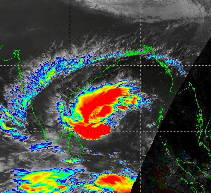
Cyclone Akvan is currently maintaining its intensity over the west-central and adjoining east-central Bay of Bengal, with low chances of making direct landfall in Bangladesh though its peripheral effects may trigger rainfall across the country.
Within 64 kilometres of the cyclone's centre, the maximum sustained wind speed is currently 75 kilometres per hour, rising to 90 kilometres per hour in gusts and squalls. The sea remains very rough near the system's centre.
Rare weather pattern and agricultural concerns
With the formation of Akvan, the Bay of Bengal has witnessed three cyclones in less than a month, a meteorological phenomenon rarely observed in the region.
While Bangladesh is spared from a direct hit, peripheral rainfall caused by the storm poses a significant threat to local agriculture. Farmers across the country are currently concerned, as even light rainfall at this stage could severely damage ripe paddy and other standing crops in the fields.
Intensification and projected path
Due to high wind shear, the system's intensification is expected to remain slow, taking considerable time to develop into a severe cyclonic storm. However, it may strengthen into a severe cyclone within the next 24 hours based on one-minute sustained wind speeds.
Once it enters more favourable conditions in the west-central Bay of Bengal, the storm could intensify somewhat faster, potentially reaching the strength of a very severe cyclonic storm—equivalent to a Category-1 hurricane—by November 19.
Like the previous systems, Akvan is most likely heading towards the Andhra Pradesh coast in India.
-SA

Loading...
Loading...
Also read









Editor : Iqbal Sobhan Chowdhury
Published by the Editor on behalf of the Observer Ltd. from Globe Printers, 24/A, New Eskaton Road, Ramna, Dhaka.
Editorial, News and Commercial Offices : Aziz Bhaban (2nd floor), 93, Motijheel C/A, Dhaka-1000.
Phone: PABX- 41053001-06; Advertisement: 41053012; 01793317829, 01550707291, 01550707296
E-mail: [email protected], [email protected]. [email protected], [email protected], [email protected], [email protected], Online-email: [email protected]
Published by the Editor on behalf of the Observer Ltd. from Globe Printers, 24/A, New Eskaton Road, Ramna, Dhaka.
Editorial, News and Commercial Offices : Aziz Bhaban (2nd floor), 93, Motijheel C/A, Dhaka-1000.
Phone: PABX- 41053001-06; Advertisement: 41053012; 01793317829, 01550707291, 01550707296
E-mail: [email protected], [email protected]. [email protected], [email protected], [email protected], [email protected], Online-email: [email protected]


