



| HEADLINE |

|

Cyclone 'Arnab' forms in Bay, signal 2 issued for ports
Published : Monday, 26 October, 2026 at 11:52 AM
Observer Online Report


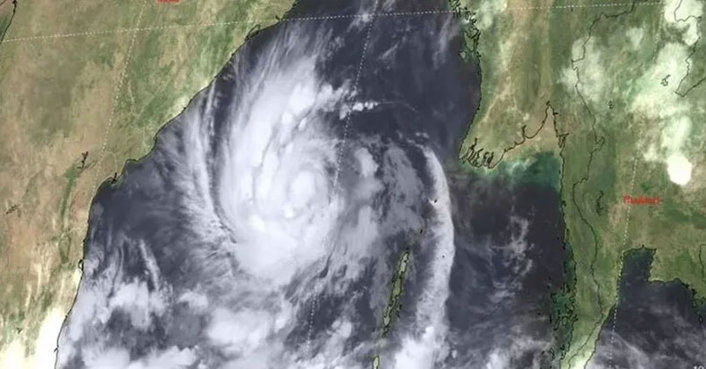
A deep depression over the Bay of Bengal has intensified into Cyclone Arnab, prompting Bangladesh to raise the maritime warning level at all four seaports as the storm is forecast to strengthen further before making landfall along India’s Andhra Pradesh coast on October 28.
The Bangladesh Meteorological Department (BMD) announced the development in Special Weather Bulletin No. 6 issued on Monday.
According to the bulletin, the deep depression over the east-central Bay of Bengal and adjoining southeast Bay of Bengal moved northwestward and intensified into Cyclone Arnab. The system is currently positioned over the east-central Bay and adjoining west-central Bay of Bengal.
At 6AM on Monday, the cyclone was located 820 kilometres southwest of Chattogram port, 745 kilometres southwest of Cox’s Bazar port, 785 kilometres south of Mongla port and 745 kilometres south of Payra port.
The BMD forecast that the system could intensify into a severe cyclonic storm by midnight on Monday as it moves west-northwestward. It may subsequently strengthen into a very severe cyclonic storm before crossing the Andhra Pradesh coast of India on October 28.
Winds near the cyclone’s centre were reaching sustained speeds of up to 62 kilometres per hour, with gusts or squalls of up to 88 kilometres per hour, the bulletin said. The sea remained very rough in the vicinity of the storm.
In response to the cyclone’s intensification, the BMD has asked the maritime ports of Chattogram, Cox’s Bazar, Mongla and Payra to lower Warning Signal No. 1 and hoist Distant Warning Signal No. 2.
Fishing boats and trawlers operating in the North Bay of Bengal have been advised to remain close to the coast and navigate with caution until further notice.

Loading...
Loading...
Also read









Editor : Iqbal Sobhan Chowdhury
Published by the Editor on behalf of the Observer Ltd. from Globe Printers, 24/A, New Eskaton Road, Ramna, Dhaka.
Editorial, News and Commercial Offices : Aziz Bhaban (2nd floor), 93, Motijheel C/A, Dhaka-1000.
Phone: PABX- 41053001-06; Advertisement: 41053012; 01793317829, 01550707291, E-mail: [email protected], [email protected] Online: email: [email protected] 41053014; 01550707297 Advertisement: 01550707296


