



| HEADLINE |

|

Industrial emissions put Sundarbans at risk
Published : Saturday, 24 October, 2026 at 12:00 AM


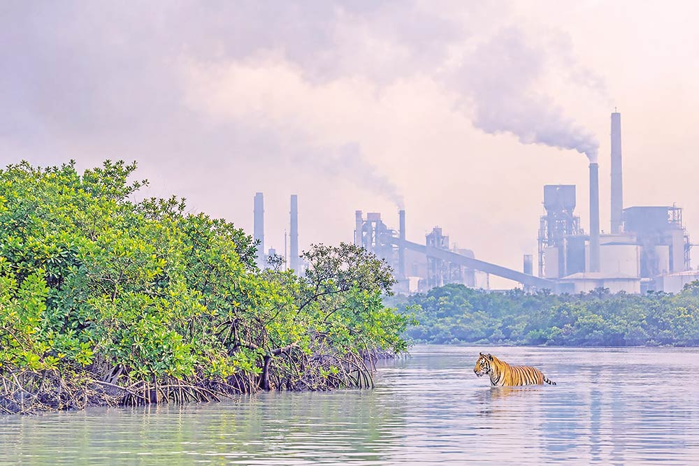 Industrial emissions around the Sundarbans are threatening the long-term health of the world’s largest mangrove forest, with experts warning that toxic dust could gradually damage vegetation and disrupt the entire ecosystem.
Air pollution affects plant growth by blocking sunlight and clogging leaf pores, known as stomata, reducing photosynthesis and weakening vegetation, said Dr Monirul H Khan, a professor of zoology at Jahangirnagar University.
As plants form the foundation of the forest’s food web, declining vegetation could have cascading effects on wildlife and the broader ecosystem, he told BSS.
A joint study by the Center for Environmental and Geographic Information Services (CEGIS) and the Arannayk Foundation found high concentrations of fine particulate matter (PM2.5) and dust (PM10) at several locations in the forest.
Field research conducted in the Khulna, Satkhira, Sharankhola and Chandpai ranges in January and February of 2024 and 2025 recorded PM2.5 concentrations of 102 micrograms per cubic metre in Sharankhola and 89.3 in Chandpai. PM10 levels reached 114 and 98.1 micrograms per cubic metre in the two ranges respectively.
Monirul attributed the deteriorating air quality to the growing number of heavy industries and cement factories around the forest, warning that the damage could accumulate over time without immediately visible signs.
Malik Fida A Khan, former executive director of CEGIS, said rapid industrialisation in the country’s southwestern region was compromising the air quality of the adjoining forest.
He noted that cement production and clinker processing release fine dust and respirable particles that can be carried towards the forest by prevailing winds.
“If the highly polluting cement factories operating around the periphery cannot be relocated or shut down, saving this vulnerable mangrove forest will become an impossible task,” he warned.
The study recommended setting up long-term atmospheric monitoring stations to track PM2.5 and sulphur dioxide (SO2). It also called for real-time meteorological data on temperature, humidity, wind speed and rainfall to help assess and forecast the spread of industrial emissions into protected areas.
The Bangladesh portion of the Sundarbans covers around 6,017 square kilometres and is a UNESCO World Heritage Site, providing vital habitat for diverse wildlife, including the Royal Bengal tiger.�"BSS

Loading...
Loading...
Also read



Editor : Iqbal Sobhan Chowdhury
Published by the Editor on behalf of the Observer Ltd. from Globe Printers, 24/A, New Eskaton Road, Ramna, Dhaka.
Editorial, News and Commercial Offices : Aziz Bhaban (2nd floor), 93, Motijheel C/A, Dhaka-1000.
Phone: PABX- 41053001-06; Advertisement: 41053012; 01793317829, 01550707291, E-mail: [email protected], [email protected] Online: email: [email protected] 41053014; 01550707297 Advertisement: 01550707296


