



| HEADLINE |

|
Bay of Bengal low pressure may turn into cyclone, says BMD
Published : Friday, 18 September, 2026 at 4:06 PM


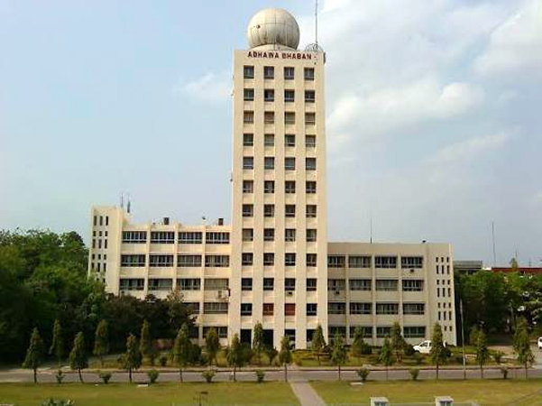
Collected Photo
A low-pressure system is expected to form over the North Andaman Sea and adjoining areas within two days, with the potential to intensify into a cyclone.
Meteorologist Md Omar Faruq of the Bangladesh Meteorological Department (BMD) stated that the system could intensify into a depression and potentially develop into a full-fledged cyclonic storm. However, current projections indicate that the system is more likely to track toward the Odisha coast of India.
Rainfall across Bangladesh is expected to increase after September 23 due to the influence of this weather system.
Addressing recent morning fog reported across various parts of the country, meteorologists explained that such temporary fog typically appears immediately after a prolonged rainfall spell ends and is expected to clear within two days.
According to the BMD morning weather bulletin, the axis of the monsoon trough runs through Rajasthan, Uttar Pradesh, Bihar, West Bengal, and central Bangladesh to Assam, extending further to the North Bay. Monsoon activity remains weak to moderately active over Bangladesh and weak over the North Bay.
Light to moderate rain or thundershowers accompanied by temporary gusty winds are expected in parts of Rangpur and Chattogram divisions, as well as isolated locations across Rajshahi, Mymensingh, Dhaka, Khulna, Barishal, and Sylhet divisions over the next 24 hours.
Day and night temperatures are projected to remain largely unchanged, with rain and thundershower activity likely increasing over the next five days.
-SA
Loading...
Loading...
Also read









Editor : Iqbal Sobhan Chowdhury
Published by the Editor on behalf of the Observer Ltd. from Globe Printers, 24/A, New Eskaton Road, Ramna, Dhaka.
Editorial, News and Commercial Offices : Aziz Bhaban (2nd floor), 93, Motijheel C/A, Dhaka-1000.
Phone: PABX- 41053001-06; Advertisement: 41053012; 01793317829, 01550707291, E-mail: [email protected], [email protected] Online: email: [email protected] 41053014; 01550707297 Advertisement: 01550707296
Published by the Editor on behalf of the Observer Ltd. from Globe Printers, 24/A, New Eskaton Road, Ramna, Dhaka.
Editorial, News and Commercial Offices : Aziz Bhaban (2nd floor), 93, Motijheel C/A, Dhaka-1000.
Phone: PABX- 41053001-06; Advertisement: 41053012; 01793317829, 01550707291, E-mail: [email protected], [email protected] Online: email: [email protected] 41053014; 01550707297 Advertisement: 01550707296


