



| HEADLINE |

|

Drought, El Niño Fuel Indonesia’s Wildfires
Published : Monday, 19 October, 2026 at 4:43 PM
Observer Online Report


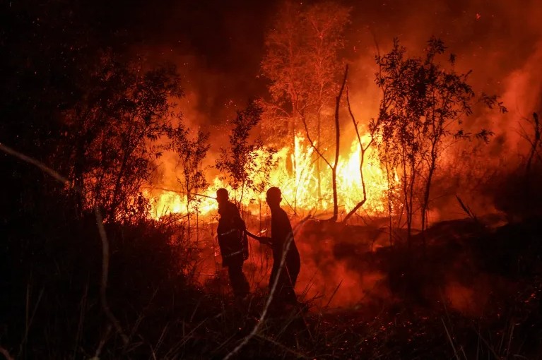
Indonesia has lost more than 1.91 million hectares of land to wildfires between January and the end of September this year, as prolonged drought and a strong El Niño phenomenon have intensified fires across the country, according to satellite data analysed by forest monitoring organisation Nusantara Atlas.
The burned area, estimated at 1,916,588 hectares, is nearly 12 times the size of London. Despite the scale of the devastation, Indonesia has yet to bring the ongoing wildfires under control.
The fires have also spread a thick haze across parts of Southeast Asia, prompting neighbouring Malaysia to renew its offer of assistance. However, Indonesian officials have rejected calls to declare the fires a national disaster, maintaining that the country still has the capacity to manage the crisis on its own.
According to Nusantara Atlas, the fires spread rapidly after drought conditions began in June, with a strong El Niño pattern further worsening the dry conditions and increasing the risk of wildfires.
Indonesia's government has yet to release its latest official estimate of the burned area. Authorities previously reported that approximately 202,000 hectares had been affected by the end of July, a figure significantly lower than the latest satellite-based assessment.
David Gaveau, founder of Nusantara Atlas, said the organisation's analysis had identified 1,916,588 hectares of burned land so far. He warned that the actual extent of the damage could be considerably higher.
Gaveau explained that the estimate may understate the true scale of the destruction for two main reasons. First, the analysis excludes burned areas smaller than 6.25 hectares. Second, the organisation applies a cautious approach to satellite data interpretation to avoid incorrectly classifying land as burned.
Dense haze this year has also obstructed satellite imagery, making it difficult at times to clearly identify fire-damaged areas and potentially leaving a portion of the destruction unaccounted for.
Despite these limitations, Nusantara Atlas data indicate that the area burned by the end of September was 38 per cent higher than during the same period in 2019.
Indonesia experienced devastating wildfires in 2015, but a direct comparison with that year is difficult because the satellites currently used for monitoring were not operational at the time. Nevertheless, Gaveau believes this year's fires could prove as severe as the 2015 disaster.
The scale of the damage, combined with prolonged drought and persistent regional haze, has raised fresh concerns about the environmental consequences of Indonesia's wildfire crisis and its impact on neighbouring countries.
- MaT

Loading...
Loading...
Also read







Editor : Iqbal Sobhan Chowdhury
Published by the Editor on behalf of the Observer Ltd. from Globe Printers, 24/A, New Eskaton Road, Ramna, Dhaka.
Editorial, News and Commercial Offices : Aziz Bhaban (2nd floor), 93, Motijheel C/A, Dhaka-1000.
Phone: PABX- 41053001-06; Advertisement: 41053012; 01793317829, 01550707291, E-mail: [email protected], [email protected] Online: email: [email protected] 41053014; 01550707297 Advertisement: 01550707296


